
Victoria Road Atlantic Seaboard Drive
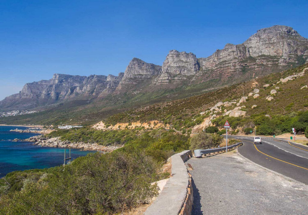
Head south out of Camps Bay with the Atlantic on one side and Table Mountain’s western wall on the other. It is an ordinary public road rather than a purpose-built tourist route, which is a large part of why it works.
Victoria Road is the coastal road that runs south from Camps Bay to Hout Bay with the Atlantic on one side and the western wall of Table Mountain on the other. It is worth saying plainly that there is nothing hidden or undiscovered about it. Thousands of people use it every day for the commute and the school run, and it is signposted, ordinary and busy. That is precisely what makes it good. This is not a purpose-built tourist route you set aside a day for. It is a working road that happens to pass through some of the finest coastal scenery in the country, which means the sightseeing costs you nothing, needs no planning and fits inside a journey you were probably making anyway.
Heading south, the drive opens at Camps Bay, where everything is wide: a long beachfront, palms along the promenade, and the mountain standing back in a broad amphitheatre behind the town. Then the road narrows and begins to climb, and the character changes quickly. The buildings thin out, the slope steepens, and you find yourself running directly beneath the buttresses of the Twelve Apostles with very little between the tar and the water. Bakoven arrives as a much smaller, quieter, more residential place, all granite boulders and tiny coves tucked below the road. Past it the coastline turns genuinely rugged around Oudekraal, with bare rock, kelp beds, white spray and fynbos slopes dropping steeply into the sea.
The southern half opens out again. The road curves and lifts, and somewhere along that stretch the Atlantic horizon simply widens in front of you, with Llandudno’s houses stacked into the mountainside below and the sea a long way down. Then comes the descent towards Hout Bay, where the valley opens up, the Sentinel appears as a distinct peak above the water, and the coast resolves into a working harbour and a bay. At that point the coastal drive becomes a place again, and you have arrived somewhere rather than simply passed through. Chapman’s Peak Drive begins from Hout Bay if you want to keep going, but this drive stands complete on its own and there is no need to treat it as a prelude.
It is worth being clear about how this differs from Chapman’s Peak, because the two are not competing for the same visitor. Chapman’s Peak is the engineering spectacle: a road cut into a cliff face, a toll gate, and a route people drive specifically because of the road. Victoria Road makes a quieter claim. Its appeal is the constant change of coastline over a relatively short distance, and the fact that ocean, mountain, beaches and neighbourhoods keep rearranging themselves around you as you go. Late afternoon is when it is at its best, with the sun out over the Atlantic and the light coming in low across the water and up onto the rock. Photographers should plan for that hour and expect company.
Practically, this is a public road rather than an attraction with a gate. There is no fee, no ticket and no opening time. End to end without stopping it takes well under half an hour, though driving it without stopping rather misses the point. Where you do stop, use the established pull-offs, parking areas and beaches rather than pausing on the verge, since the road is narrow in places with blind corners and stopping outside proper laybys is both unsafe and often not allowed. Expect slow going on summer weekends, over the December holidays and around sunset in both directions, and share the road with a steady stream of cyclists. It works equally well in either direction, but travelling north to south gives the landscape its most natural progression.
Twelve Apostles
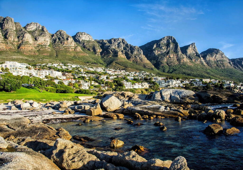
The wall on your left, named. There is no single viewpoint for it. The range is read from a series of public stopping places along the road, so it is something you drive through rather than arrive at.
The Twelve Apostles are the chain of rock peaks and buttresses that form the western wall of Table Mountain, rising above the Atlantic Seaboard between Camps Bay and Hout Bay. They are one of Cape Town’s defining landscapes, and it is worth being clear about what visiting them means, because there is no single Twelve Apostles viewpoint, no gate and no parking area with a sign on it. You do not travel to one pin on a map. You experience the range from a series of places along the Atlantic coast, and the view changes as you move.
Seen from below, the effect is of a long grey wall standing directly over the sea. Sheer buttresses drop into steep scree and fynbos slopes, which run down almost to the road and then to the water, so mountain and ocean sit in the same field of view with very little in between. That compression is what makes the landscape feel so dramatic compared with mountains that are approached across a plain. There are not literally twelve peaks, and counting them is a waste of a good view. What matters is the rhythm of the buttresses, one after another, holding the light differently depending on where the sun is.
The range rewards movement. From Camps Bay and Bakoven you are close underneath the northern buttresses, and they loom, filling the sky behind the beach and the rooftops. Continue south past Oudekraal and the angle opens out: you begin to look back along the wall rather than straight up at it, and the range reads as a single continuous formation instead of a series of separate faces. Further on towards Llandudno the mountain steps back from the coast and the view becomes wider and more distant. Victoria Road strings these perspectives together and will give you repeated views as you go, but the road is not the attraction here. The mountain is.
Light and weather do more to this landscape than location does. Late afternoon is the time most people remember, when the sun swings out over the Atlantic and the west-facing rock turns warm and gold before the whole wall falls into silhouette at sunset. Mornings are the opposite, with the faces in shadow and the detail flat, though the air is often clearer. Cloud changes everything: the tablecloth spilling over the top edge, or low mist erasing the peaks entirely and then lifting to reveal them. Photographers should plan around the afternoon and be patient with weather, since a grey hour here can turn spectacular in ten minutes.
Looking at the Twelve Apostles and going onto them are two very different propositions. The slopes above are part of Table Mountain National Park, and the routes that climb into the ravines between the buttresses are serious mountain walks that need proper preparation, not casual detours from the beach. The overwhelming majority of visitors experience this range exactly as it is meant to be experienced from below, which is why it belongs among viewpoints rather than trails. There is nothing to book, nothing to pay and nothing to open or close. You simply need to be somewhere along the Atlantic Seaboard with the mountain in front of you, ideally in the late afternoon.
Hout Bay Harbour
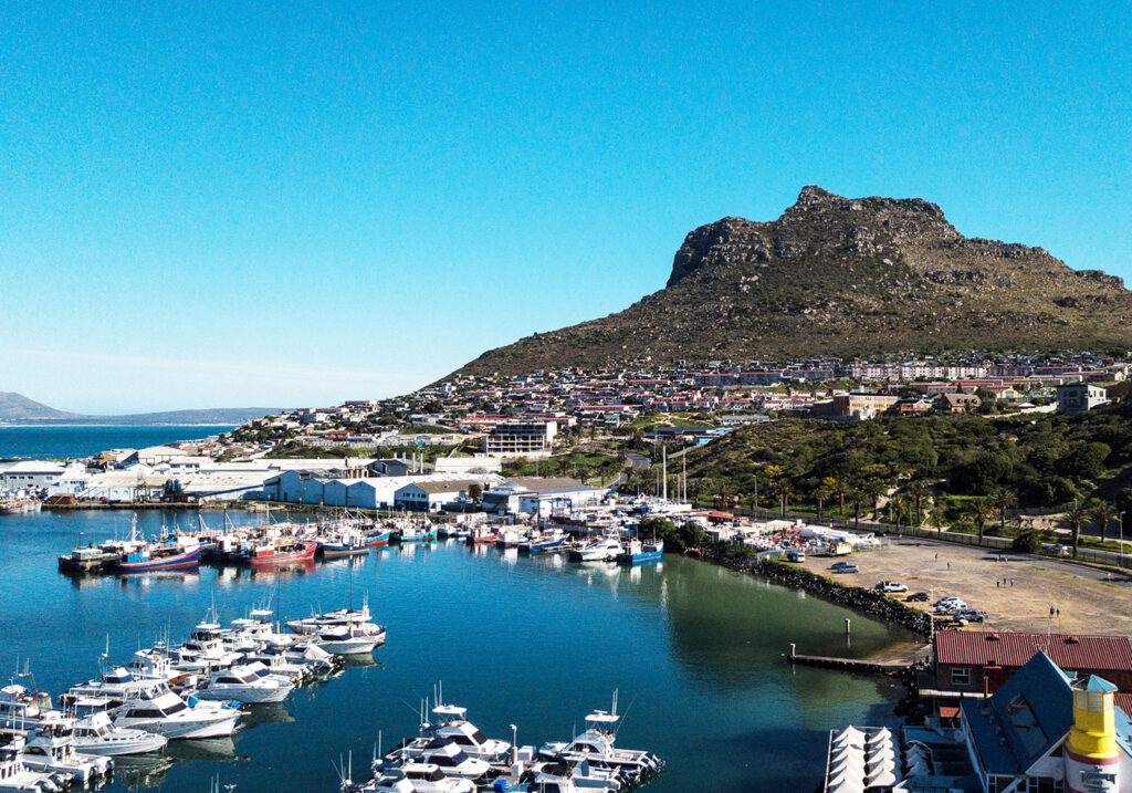
The first proper stop. Cape Town’s busiest working fishing harbour, under the Sentinel, with trawlers on the quays, seals patrolling the moorings and the Bay Harbour Market alongside at weekends.
Hout Bay Harbour is Cape Town’s busiest working fishing harbour, tucked into the western corner of Hout Bay beneath the blunt rock face of the Sentinel. It is worth setting expectations properly: this is not a redeveloped waterfront. Boats are unloaded here, gear is repaired here, and people work here. Visitors are welcome and there is plenty to look at, eat and do, but the harbour has not been tidied up for them, and that is exactly what makes it interesting.
What you actually do is walk around and watch. Fishing boats and trawlers lie two and three deep against the quays, paintwork weathered, decks stacked with crates and coiled rope, while smaller craft and pleasure boats fill the moorings further in. There is a constant low-level activity to it: engines idling, boats coming and going, gulls working the water, crew moving between vessels. Cape fur seals turn up regularly around the boats and the slipways, hauled out on whatever they can reach or cruising the harbour in the hope of scraps. They are one of the harbour’s reliable pleasures, though nothing about wild animals is guaranteed, and the seal colony proper is out in the bay rather than here.
The setting does a great deal of the work. The Sentinel rises almost vertically above the harbour on one side, close enough to fill the sky, with the houses of Hangberg spread across its lower slopes. Look the other way and the bay opens out, with the mountains of the far shore running toward Chapman’s Peak. It is a genuinely good place to photograph, particularly early in the day when the boats are moving and the light is coming across the water, or late in the afternoon when the Sentinel goes gold and the harbour empties out.
Around the working core there is the visitor side of things. Boats leave from here for trips out into the bay, including the run to the seal colony, and there is seafood to be had along the waterfront, from proper sit-down places to fish and chips eaten standing up. Bay Harbour Market operates in a converted building on the harbour edge and pulls a substantial crowd of its own. None of it has quite been polished into a destination, and the honest description is somewhere between the two extremes people tend to reach for: it is not a picture-postcard fishing village, and it is not a luxury waterfront either. It is the harbour of a modern Cape Town suburb, doing real work, with visitors woven into it.
Practically, there is no general admission fee to visit Hout Bay Harbour. Restaurants, markets, boat operators and other businesses around the harbour keep their own operating hours, and excursions may require advance booking. An hour is enough to see it properly, which makes it easy to fold into a wider Hout Bay outing alongside the beach, the market or the drive over Chapman’s Peak. Do keep clear of operational areas, vehicles and moorings and take any signage seriously. This is a place of work first, and the boats are not exhibits.
Chapman’s Peak Drive
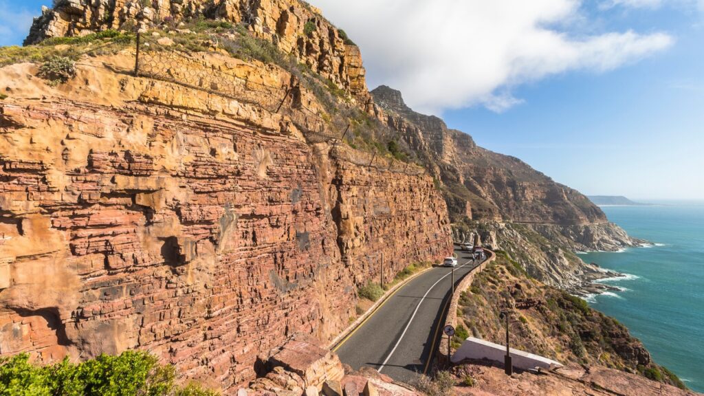
The famous stretch, cut into the cliff between Hout Bay and Noordhoek, with viewpoints and picnic spots the whole way. The one section of the day where the driving is the attraction outright.
Chapman’s Peak Drive is widely regarded as one of the world’s most beautiful coastal roads. Winding along towering cliffs between Hout Bay and Noordhoek, the route offers unforgettable views across the Atlantic Ocean, dramatic mountain landscapes and some of Cape Town’s finest photography locations.
The drive features numerous viewpoints where visitors can stop to admire the scenery, capture photographs or simply enjoy the changing colours of the coastline. It is equally popular with motorists, cyclists, runners and visitors looking for a memorable sunset experience. During the summer months, the west-facing coastline creates spectacular evening light over the ocean.
Chapman’s Peak Drive is also an important link between two of Cape Town’s most popular coastal destinations. Whether you’re exploring the Cape Peninsula, planning a scenic road trip or simply looking for one of the city’s best viewpoints, it remains an experience that showcases the natural beauty of the Western Cape.
Slangkop Lighthouse
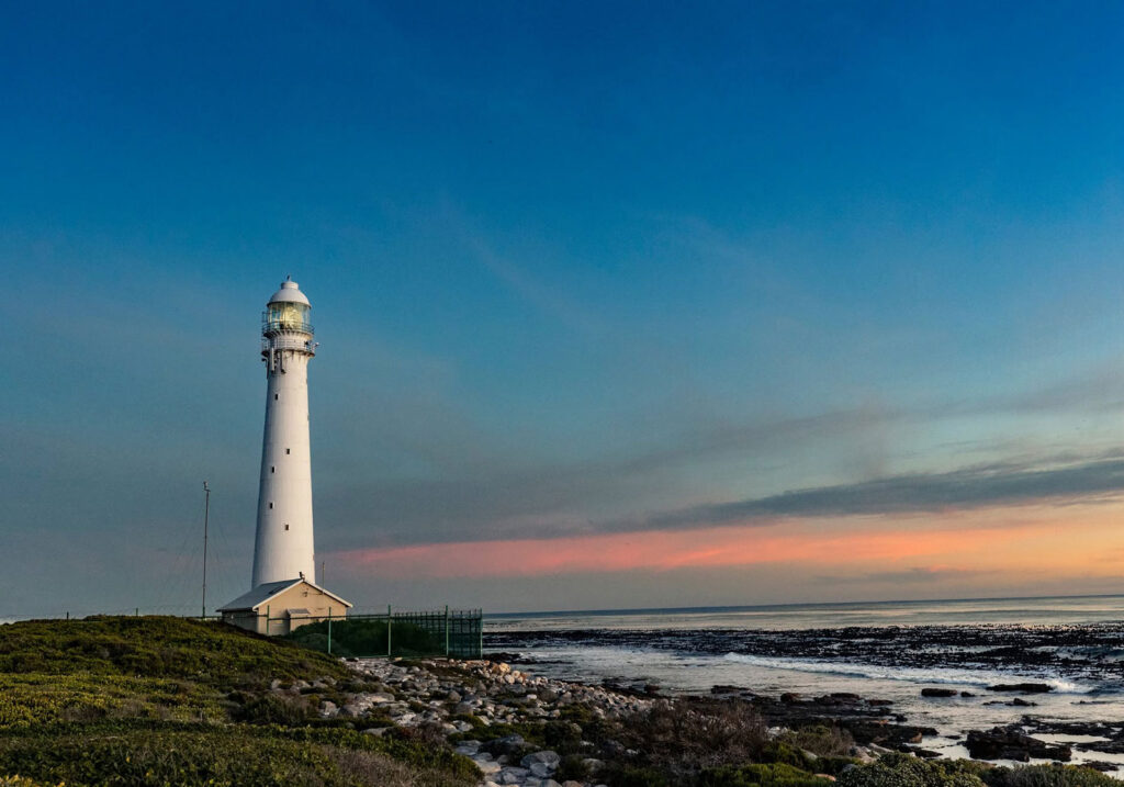
A short detour west at Kommetjie to a thirty-three metre cast-iron tower on the exposed Atlantic edge of the peninsula. Still working, and usually open to climb on weekdays.
Slangkop Lighthouse stands on the open Atlantic shore just west of Kommetjie, towards the southern end of the Cape Peninsula. At thirty-three metres it is the tallest cast-iron lighthouse on the South African coast, and it is still a working navigational light rather than a preserved monument. The setting does as much work as the structure. There is low coastal fynbos, dark rock shelving into white water, unbroken Atlantic to the horizon, and the hill rising behind that gives the place its name — Slangkop, the snake head.
The tower itself is worth looking at properly. It is cast iron rather than masonry, built up from curved plate sections bolted together, tapering as it rises and painted white from base to lantern. A railed gallery runs around the top beneath a domed lantern room, and single-storey keeper’s quarters sit at the foot of the tower behind a low fence. Because the surrounding landscape is flat, scrubby and empty, the tower reads as very tall and very slender from a distance, visible from the roads coming into Kommetjie long before you reach it.
A light was needed here because of what this coastline does to shipping. The western edge of the Peninsula is the last stretch that vessels approaching Table Bay from the south and west run along, and it is an unforgiving one: reef, kelp, heavy Atlantic swell and frequent low cloud against a shore that offers nothing to shelter behind. The coast either side of Kommetjie has a long record of wrecks. A commission appointed in 1906 recommended establishing a light at Slangkop.
The construction timeline is the detail most often reported incorrectly. The lens, tower and associated equipment were manufactured in 1914, and completion was expected in that year — a brass sign was even produced carrying the 1914 date. The First World War then intervened, and the lighthouse was not formally completed and commissioned until 1919, with its inauguration on 4 March that year. It appears to have been in use before the official date, as a Royal Navy ship’s log records the light in July 1917. That gap between manufacture, working use and formal commissioning is why you will see 1914, 1917 and 1919 all attached to this lighthouse.
It remains an active navigational lighthouse, operated by Transnet National Ports Authority. The light group-flashes four times every thirty seconds from a first-order revolving lens turning in a bath of mercury, with the focal plane roughly forty-one metres above high water so that the beam sits below the dense mist that regularly settles on this coast. The station was automated in 1979. What was originally a three-man posting has since been held by a single senior lightkeeper, and the site is still staffed rather than left to run itself.
Visitors have generally been able to go inside and climb the tower, which is the main reason to make the trip rather than simply photograph it from the road. The published viewing period is Monday to Friday, roughly 10:00 to 15:00 with a short break around midday, and closed on weekends and public holidays. That information is not published with a clear date attached, so confirm current access before making a special journey. The climb is up a steep, narrow internal spiral staircase, which will rule it out for some visitors and for anyone uneasy with confined stairs or heights. From the gallery at the top the reward is the coastline in both directions, the reef and kelp beds directly below, and open ocean with nothing between you and the South Atlantic.
Getting here is part of it. Kommetjie sits well down the Peninsula, and however you approach — over the mountain from the False Bay side, or down the Atlantic coast — the landscape becomes progressively emptier and more exposed as you go. A road runs out through the village to the lighthouse itself. Most people pair the visit with time on the shoreline nearby, and the wind here is genuine: on a blown-out afternoon the walk from car to tower is bracing in a way that a promenade lighthouse never is. Late afternoon gives the best light on the white tower, but the tower interior closes well before sunset, so the two do not combine.
Simon’s Town Harbour
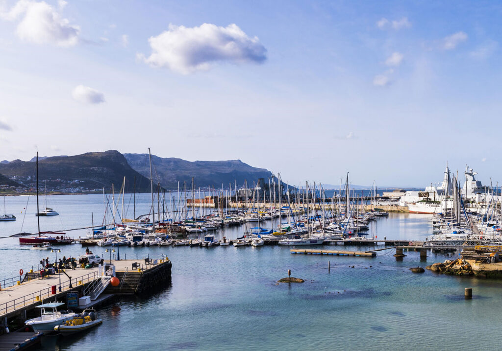
Cross to the False Bay side. A naval and maritime harbour in a sheltered corner beneath steep mountains, with grey ships often visible across the water and a town built around them.
Simon’s Town Harbour is the maritime waterfront of a town that exists because of it. The harbour sits in a sheltered corner of False Bay, tucked under steep mountains on the eastern side of the Cape Peninsula, and it has been in continuous naval and maritime use for a very long time. That is what makes it different from Cape Town’s other harbours: this is not primarily a fishing harbour or a redeveloped visitor precinct, but a working naval and maritime setting that a visitor experiences from around its edges.
What you actually see from the public waterfront is a busy mix of vessels. Yachts and small craft fill the marina in rows, tenders and service boats move about, and there are usually working boats of one kind or another alongside the quays. Beyond them, grey naval vessels are often visible across the water, which immediately tells you what kind of harbour this is. What is in port varies from day to day, so treat any particular ship as a matter of luck rather than something to plan around.
A little history helps explain the shape of the place. Simon’s Town grew up around this anchorage because False Bay offered shelter when Table Bay was dangerous in the winter months, and the harbour was steadily developed as a naval station over the following centuries. It served as a Royal Navy base for much of that period before passing to the South African Navy in the second half of the twentieth century, and the Navy remains here today. That long history is why a small town on a narrow coastal shelf has a harbour of this scale, and why its architecture, street pattern and atmosphere all lean toward the sea.
It is worth being clear about access. The naval presence shapes the character of Simon’s Town, but naval facilities are operational and are not visitor attractions. Public areas around the waterfront, the marina side and the town’s seafront are where the experience happens, and the boundaries are generally signposted. Do not assume that because something is part of the harbour it is open to walk through, and treat signage and any instruction from personnel as the final word. Photography restrictions can also apply around naval areas, so use discretion with the camera near anything operational.
The setting does a great deal of the work. Mountains rise almost immediately behind the town, so the harbour is pressed into a thin strip between rock and water, and False Bay opens out to the east with the Hottentots Holland mountains visible on the far side on clear days. Walking the public waterfront is pleasant and undemanding, the light across the bay changes markedly through the day, and the combination of masts, grey hulls, mountains and open water is unusually photogenic for a harbour of this size. Seals and seabirds are often around the water, though they come and go as they please.
Practically, there is no general admission fee to visit the public waterfront at Simon’s Town Harbour, and there is no single harbour-wide schedule: restaurants, businesses, boat operators and museums around the waterfront all keep their own hours, and access to particular areas can change. The harbour itself is compact and takes well under an hour to see, so most visitors fold it into a longer Simon’s Town outing with food, the town’s museums and streets, and Boulders Beach a short distance away. Parking along the seafront is limited and fills up quickly on weekends and in high season.
Kalk Bay Harbour
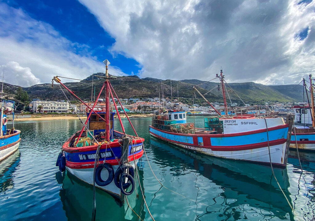
Twenty minutes north, and the opposite kind of harbour. Compact, working, built into the middle of the village, with fish sold on the quay when the boats come in and seals drifting round the moorings.
Kalk Bay Harbour is a small working fishing harbour set directly into the middle of Kalk Bay village on the False Bay coast. What defines it is the scale. There is no precinct to navigate and no distance between the harbour and everything around it: you turn off the main road, walk through a gap, and you are on the quay with the boats. Fishing vessels, fish sellers, seals, restaurants, the railway line and the village streets all occupy an area you can cross in a couple of minutes, and that compression is the whole character of the place.
Up close the boats do most of the work. They are mostly small wooden vessels, painted in reds, blues and greens that have taken a beating from the salt, moored a few metres from where you stand rather than behind a fence. When boats come in, fish are landed and sold right there on the quay, cleaned and cut in front of whoever is queuing, and the harbour becomes briefly loud and crowded and businesslike. Whether you catch that depends entirely on the day, the weather and the catch, so it is best treated as a bonus rather than the plan. Seals are a common presence too, hauled out on the slipway or working the water around the moorings, though they come and go as they please.
The setting is unusually tightly packed. Beyond the harbour wall False Bay opens out to the horizon, and the mountains rise almost straight up behind the village, so the whole settlement is pressed into a narrow shelf between the two. The railway line runs along that shelf between the houses and the sea, close enough that trains pass just above the water. It makes for very good photography: the boats give you colour and detail, the harbour wall gives you a foreground, and the light coming off False Bay changes constantly through the day.
There is seafood to be had here, eaten within a few metres of the water, from counter-service fish and chips to restaurants sitting over the harbour itself. Beyond that, Kalk Bay village carries on up the hill and along the main road with its cafés, antique shops, galleries and bookshops, and that is a separate outing with its own character. This page is about the working waterfront. The village is worth its own morning.
Practically, there is no general admission fee to visit Kalk Bay Harbour. Restaurants, fish sellers and other businesses around the harbour keep their own operating hours, and fishing activity varies from day to day. The harbour itself takes twenty minutes or half an hour to see properly, so any longer visit is really about eating, photographing or drifting into the village, and it is worth saying that most people do exactly that. Parking along the main road is tight and gets much worse on weekends and holidays. It remains a working harbour, so keep clear of the slipway, the vehicles and anyone moving fish.
Boyes Drive
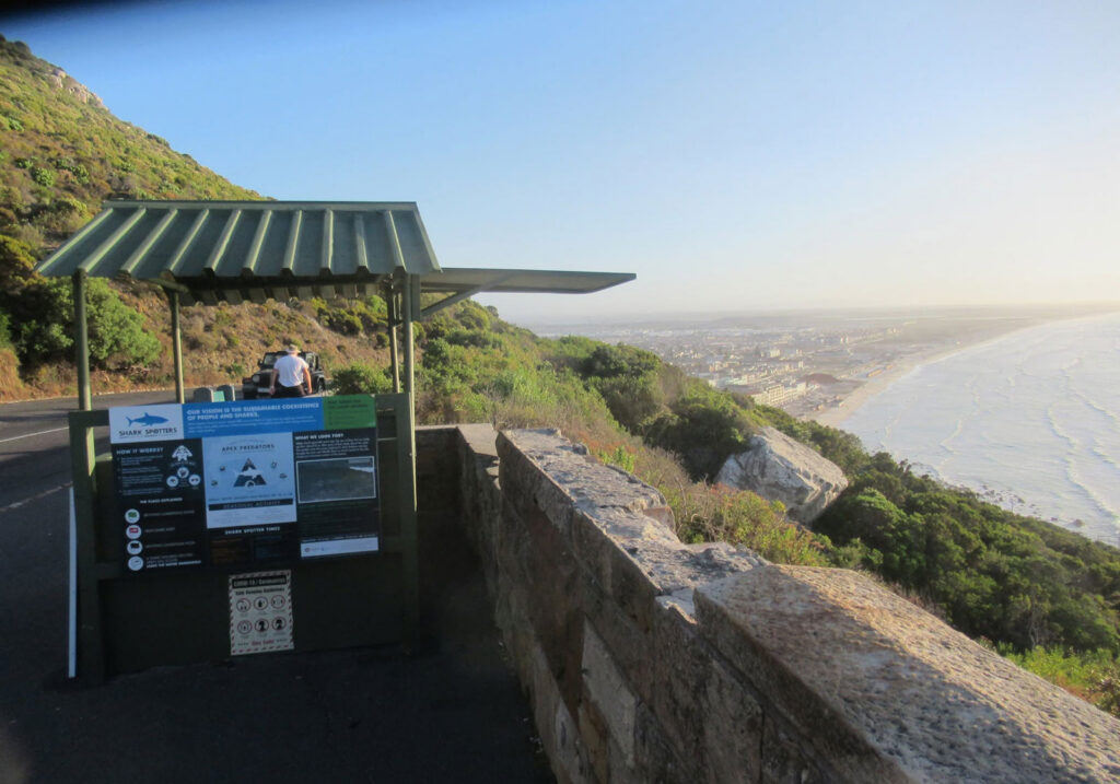
Climb out of Kalk Bay onto the mountainside road above the railway line. False Bay becomes something you look across rather than out at, which is the whole argument for taking it instead of the main road.
Boyes Drive is the road that runs along the mountainside above Muizenberg, St James and Kalk Bay, a good way up from the coastal road most people use. It exists largely as a local alternative to the Main Road below, and there is nothing remarkable about the road itself: two lanes, houses along one side in places, a low stone wall on the other. What makes it worth driving is the height. From up there False Bay stops being something you look out at from the water’s edge and becomes something you look across, and the shape of the whole coastline is suddenly legible in a way it never is from sea level.
The classic run is short, from the Muizenberg end through to Kalk Bay, a few kilometres and ten minutes or so if you don’t stop. The road climbs away from Muizenberg and the view arrives almost immediately: the beachfront and its long line of surf directly below, Zandvlei and the flat wetland country lying behind the coastal strip, and then False Bay opening out until the mountains on the far side close it off. As the road curves along the slope the perspective keeps shifting. The rooftops of St James and then Kalk Bay pass beneath you, the coast narrows to a thin strip between mountain and sea, and you can see exactly how tightly these suburbs are wedged into that gap. It is the kind of view that makes sense of a place.
In the colder months, roughly winter into spring, southern right whales come into False Bay, and Boyes Drive is one of the better places to look for them precisely because of the elevation. Looking down at the water rather than across it makes them far easier to pick out, and you can do it without a boat, a ticket or a crowd. It is worth being realistic: this is an opportunity rather than a guarantee, and plenty of people drive it in season and see nothing at all. That same elevation is what makes the road good for photography. From up there the beach, the wetlands, the coastal suburbs and the bay can be framed as a single landscape, which is close to impossible from the shoreline.
Keep the scale of it in proportion. This is not a half-day road trip and it is not trying to be Chapman’s Peak. It works best as a short detour, or simply as the scenic way between Muizenberg and Kalk Bay when you would otherwise take the Main Road, easily folded into a wider False Bay day. It is a public road with no fee and no gate, but it is also residential in places, narrow and winding, with blind bends and cyclists who use it heavily. Stop only where there is a proper pull-off or parking area rather than on the road itself, and leave the driving to the driver. Most of the good looking here is done by passengers.
Ou Kaapse Weg
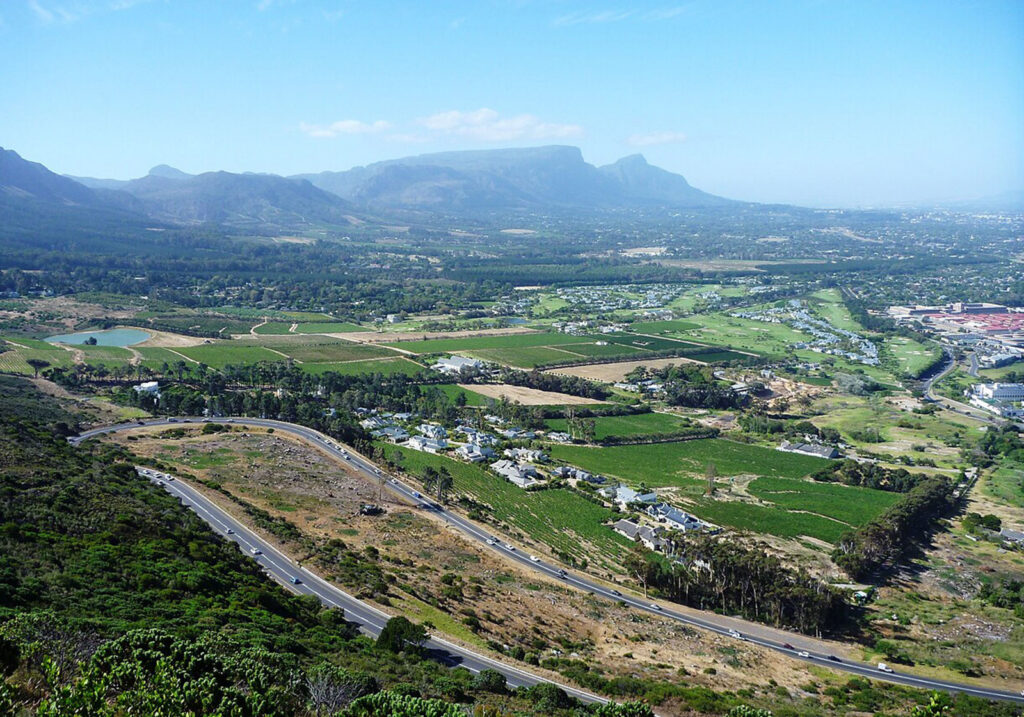
The other way home, and the one to use if you turn back at Noordhoek rather than doing the full loop. It crosses the spine through the Silvermine landscape between the Tokai side and the Noordhoek valley.
Ou Kaapse Weg, the Old Cape Road, is the mountain crossing that links Cape Town’s southern suburbs with the southern peninsula. It is not a coastal road and it is not a lookout you drive to. It is a pass, and the reason to take it is the crossing itself. You leave the suburbs behind at the Tokai and Steenberg end, climb steadily into open mountain country, run along the high ground through the Silvermine section of Table Mountain National Park, and come down the far side into the Noordhoek valley. In about fifteen minutes of driving you move between two parts of the same city that feel almost unrelated.
The change happens quickly. The northern approach begins among vineyards, smallholdings and the outer edges of the southern suburbs, close enough to the city to feel completely ordinary, and then the road tilts upward and starts working its way onto the mountainside. The houses thin out and stop. Valley greenery gives way to fynbos and bare rock, and within a couple of minutes there is nothing built on either side of you. The high section is open, exposed mountain country, the road running through the Silvermine landscape with the ground falling away on both sides. Then it crests and starts down, and the view ahead reorganises itself entirely: the Noordhoek valley opens up below, the peninsula narrows, and it is obvious you are arriving somewhere quite different from where you started.
That is the real value of the drive, and it is worth saying plainly. On a map, the southern suburbs and the southern peninsula look like neighbours. Ou Kaapse Weg makes the mountain between them tangible. You feel the climb, you cross a genuine barrier, and afterwards Cape Town’s geography makes far more sense than it did before. The views come as a sequence rather than a single payoff, back over the suburbs and the flats on the way up, out toward False Bay from the high ground, then the Noordhoek valley and the Atlantic side on the descent, and no one of them is the reason to be there. The road also passes through Silvermine, which is a destination in its own right with trails, a reservoir and picnic areas, but that is somewhere to stop and spend time rather than part of the drive. On Ou Kaapse Weg you travel through the landscape rather than into it.
Practically, this is an everyday Cape Town route rather than an adventure, carrying commuter traffic in both directions all day. It is a well-maintained public road with no fee and no gate. It does ask for some attention: the climbs and descents are sustained, the bends are continuous, and it carries a lot of cyclists who treat it as a serious training climb. Mountain weather is the main variable, since cloud can sit on the high ground and remove the view completely and the wind at the top can be considerable, so a clear day matters more here than on the coastal drives. Stop only where there is a proper pull-off or parking area. Most people drive it on the way to somewhere else, heading for Noordhoek, Kommetjie, Scarborough or Cape Point, and that is exactly how it works best: choosing this route rather than the alternative turns a transfer into part of the day.