Ou Kaapse Weg is the mountain crossing between Cape Town's southern suburbs and the southern peninsula, climbing from the Tokai and Steenberg side through the Silvermine mountain landscape and dropping into the Noordhoek valley. The appeal is the crossing itself rather than any single viewpoint: about fifteen minutes of driving that makes the city's mountain geography suddenly obvious.
Ou Kaapse Weg, the Old Cape Road, is the mountain crossing that links Cape Town's southern suburbs with the southern peninsula. It is not a coastal road and it is not a lookout you drive to. It is a pass, and the reason to take it is the crossing itself. You leave the suburbs behind at the Tokai and Steenberg end, climb steadily into open mountain country, run along the high ground through the Silvermine section of Table Mountain National Park, and come down the far side into the Noordhoek valley. In about fifteen minutes of driving you move between two parts of the same city that feel almost unrelated.
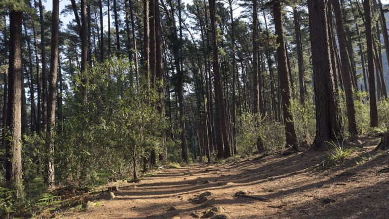
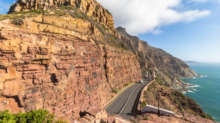
The change happens quickly. The northern approach begins among vineyards, smallholdings and the outer edges of the southern suburbs, close enough to the city to feel completely ordinary, and then the road tilts upward and starts working its way onto the mountainside. The houses thin out and stop. Valley greenery gives way to fynbos and bare rock, and within a couple of minutes there is nothing built on either side of you. The high section is open, exposed mountain country, the road running through the Silvermine landscape with the ground falling away on both sides. Then it crests and starts down, and the view ahead reorganises itself entirely: the Noordhoek valley opens up below, the peninsula narrows, and it is obvious you are arriving somewhere quite different from where you started.
That is the real value of the drive, and it is worth saying plainly. On a map, the southern suburbs and the southern peninsula look like neighbours. Ou Kaapse Weg makes the mountain between them tangible. You feel the climb, you cross a genuine barrier, and afterwards Cape Town's geography makes far more sense than it did before. The views come as a sequence rather than a single payoff, back over the suburbs and the flats on the way up, out toward False Bay from the high ground, then the Noordhoek valley and the Atlantic side on the descent, and no one of them is the reason to be there. The road also passes through Silvermine, which is a destination in its own right with trails, a reservoir and picnic areas, but that is somewhere to stop and spend time rather than part of the drive. On Ou Kaapse Weg you travel through the landscape rather than into it.
Practically, this is an everyday Cape Town route rather than an adventure, carrying commuter traffic in both directions all day. It is a well-maintained public road with no fee and no gate. It does ask for some attention: the climbs and descents are sustained, the bends are continuous, and it carries a lot of cyclists who treat it as a serious training climb. Mountain weather is the main variable, since cloud can sit on the high ground and remove the view completely and the wind at the top can be considerable, so a clear day matters more here than on the coastal drives. Stop only where there is a proper pull-off or parking area. Most people drive it on the way to somewhere else, heading for Noordhoek, Kommetjie, Scarborough or Cape Point, and that is exactly how it works best: choosing this route rather than the alternative turns a transfer into part of the day.
Highlights
- A genuine mountain pass rather than another coastal drive
- The climb out of the southern suburbs into open fynbos and mountain country
- The high crossing through the Silvermine section of Table Mountain National Park
- The Noordhoek valley opening up on the descent
- A sequence of changing views rather than one fixed panorama
- A free public road and the scenic way toward the southern peninsula
Tips
Take it on a clear day, since cloud on the high ground removes the point of the drive. Expect sustained climbing and descending, and use a lower gear on the way down. Watch for cyclists, who use this as a training climb. Stop only at proper pull-offs and parking areas rather than on the road. It works best as the scenic route toward Noordhoek, Kommetjie or Cape Point rather than as an outing in its own right, and Silvermine is worth a separate visit if you want to get out and walk.
Frequently Asked Questions
What is Ou Kaapse Weg?
Ou Kaapse Weg, meaning Old Cape Road, is the mountain pass connecting Cape Town's southern suburbs with the southern peninsula. It climbs from the Tokai and Steenberg side, crosses the high ground through the Silvermine section of Table Mountain National Park, and descends into the Noordhoek valley.
How long does it take to drive?
About fifteen minutes to cross when the road is clear. It is normally driven as part of a longer journey rather than as a trip on its own.
Is it a difficult drive?
No. It is a well-maintained everyday route used by commuters in both directions. The gradients and bends are sustained, so drive it steadily, watch for cyclists, and be prepared for cloud and wind on the high ground.
What is there to see along the way?
The interest is in the sequence rather than one lookout: the suburbs and flats behind you on the climb, open fynbos and mountain scenery across the high section, and the Noordhoek valley and the peninsula ahead on the descent.
Should I take Ou Kaapse Weg or the coastal route?
Ou Kaapse Weg is the mountain option and the quicker crossing to Noordhoek and Kommetjie. The coastal routes give you a completely different kind of scenery, and Chapman's Peak Drive begins at the Noordhoek end if you want to continue that way.