
CAPE TOWN ACTIVITIES
Easy Hikes and Walks in Cape Town
For the visitor with a couple of hours, ordinary shoes and no interest in a summit. Nine walks chosen from what the reserves and gardens themselves say, not from a difficulty column.
Willis Walk
A level coastal footpath following the shore between Simon’s Town and Seaforth. SANParks names it in its own material and permits dogs on lead. There is no climbing, no gate and no fee, and it finishes at the stretch of coast the penguins have claimed. For a short walk that still feels like the peninsula, it is hard to beat.
Willis Walk is one of the quieter finds on the peninsula. It is a coastal footpath connecting Bellevue Road in Simon’s Town with Kleintuin Road at Seaforth, running along the shore below the slopes. SANParks names it in its own park material.
The important distinction is with Boulders. The penguin colony boardwalks at Boulders and Foxy Beach are a paid attraction entered through their own gate, and this footpath is not part of them. Willis Walk is free. Penguins do range along this stretch of coast, so you may well see them from the path, but seeing them here is a matter of luck rather than an included ticket.
It is also one of the few places in Table Mountain National Park where dogs are permitted, on a lead. It is a short link between two roads, walkable from either end, and Seaforth is the easier place to leave a car.
Silvermine Reservoir Boardwalk
SANParks describes a boardwalk of roughly twenty-five minutes along the bank of the Silvermine reservoir, level for its whole length and close to the day-visitor parking. It is the easiest walk we can name, and the only one on this list that works for a wheelchair or a pram. Silvermine is gated, so there is a conservation fee and a last-entry time.
The Silvermine reservoir boardwalk is the shortest walk we list, and it is here deliberately. SANParks identifies a boardwalk trail of approximately twenty-five minutes on the banks of the reservoir, and it is level the whole way, which makes it the one outing in Silvermine that suits people who cannot manage a mountain path.
It starts at the reservoir day-visitor parking inside Gate 1 on Ou Kaapse Weg, and runs beside the water. Two much longer routes leave from the same area, the Panorama Loop and the climb to Elephant’s Eye, so it is worth being clear which one you are setting out on before you park.
Silvermine is a gated section, so a daily conservation fee is payable at the gate, which takes card only, and last entry is an hour before closing.
Olifantsbos Shipwreck Trail
One of only two trails SANParks names in the Cape of Good Hope section. It runs north along the shore from the Olifantsbos car park past the remains of two wrecks. The walking is flat; what makes it demanding is the exposure, so it wants a wind check and a hat rather than fitness.
The Shipwreck Trail is the walk to do at Cape Point if you would rather look at the sea than climb above it. It leaves the car park at Olifantsbos, on the Atlantic side of the Cape of Good Hope section, and follows the shore north across sand and low coastal path. Two vessels lie on this stretch, and the wreckage is the reason the trail has a name.
SANParks names the trail in its own visitor material. What matters more in practice than a kilometre count is the gate: the Cape Point entrance closes in the late afternoon and a late exit is fined, so work backwards from that.
There is no shade and no water once you leave the car park, and baboons are active on this side of the reserve. SANParks asks visitors to keep food out of sight and warns that the animals are attracted by it. Dogs are not permitted anywhere in this section.
Disa Kloof Trail
A very short trail inside Harold Porter National Botanical Garden, running about 950 metres from the entrance to the Disa Kloof waterfall and back, roughly half an hour each way. It is level, it needs no permit, and it is the reason to stop in Betty’s Bay even if the mountain behind it is not on your plan.
Disa Kloof is the short one, and it is here because of what it does rather than how far it goes. It is a very easy short trail, 950 m from the garden entrance up the kloof to the waterfall, about thirty minutes each way. What matters is the surface: the whole route is accessible to wheelchair users and to parents pushing prams, which is rare enough on this coast to be the point of the page. The garden lends two wheelchairs free at the entrance gate.
Harold Porter sits at the foot of the Kogelberg mountains in Betty’s Bay, on the corner of Clarence Drive and Broadwith Road, and it is open every day of the year. Admission is payable at the gate. The walk leaves from the entrance and follows the kloof up to the falls, through cultivated garden that gives way to the natural fynbos estate behind it. If you come between late December and the end of January, the red disas are flowering in this kloof.
Do not confuse it with Leopard’s Kloof, the other waterfall walk in the same garden. That one needs a permit and a key collected before one in the afternoon, and it climbs river crossings and a series of ladders. Disa Kloof asks nothing of you but half an hour, and ordinary shoes will do.
Palmiet River Trail
CapeNature grades this one easy, and the contrast with its neighbours makes the point: Kogelberg’s other routes run to 22 and 24 kilometres, while this one follows the Palmiet River and stays low. It is the longest walk in this guide and the least strenuous, which is worth saying to anyone who equates hours with effort.
Kogelberg is the heart of the Cape Floral Kingdom and most of its trails are long: 22 km to Perdeberg, 24 km on the Kogelberg Trail, a two-day crossing on the Highlands. The Palmiet River Walk is the exception. It is 10 km over about three hours, an easy walk along the Palmiet River, which makes it the way into this reserve for people who want the fynbos and the water without committing a whole day to a mountain.
The reserve is reached off the R44 between Kleinmond and Betty’s Bay, down a gravel road to the Oudebosch reception where permits are issued. Buy the permit there or book it in advance through CapeNature. Day-visitor parking is limited and works on a first come, first served basis, so an early arrival is worth more here than it is at most reserves. CapeNature recommends starting the walk no later than two in the afternoon.
Two things worth knowing. Easy is CapeNature’s grading, not a comment on the length, and ten kilometres is still ten kilometres, so take water and closed shoes. And there is no cell reception inside the reserve, with the last signal at the turn from the tar onto the gravel. Tell someone where you are going before you lose it.
Tweede Waterval (Second Waterfall)
The reserve’s own easiest route, following the Eerste River upstream past the first waterfall to the second. CapeNature permits 250 people a day on it against 100 on the mountain routes, and allows it as the final descent of the long circuit. It is short enough to fit around lunch.
Tweede Waterval is the gentlest of the four official trails in Jonkershoek Nature Reserve, and the one most visitors do. The path leaves the hairpin bend on the reserve’s circular route and follows the Eerste River upstream, passing the first waterfall on the way to the second.
It is short enough to fit around lunch and easy enough for children, which is why CapeNature allows 250 people a day on it rather than the 100 permitted on the mountain routes. It also doubles as the final descent of the Panorama Circuit, so anyone walking the long day will finish along this same path.
Swartboskloof to Sosyskloof
The easy circuit in Jonkershoek, and it begins on exactly the same climb as the reserve’s long day. Where the big route carries on up the kloof, this one forks and comes back. If you want the Jonkershoek amphitheatre without the eight-hour version of it, this is how you get it.
Sosyskloof is the easy loop in Jonkershoek, and it begins on exactly the same climb as the eighteen-kilometre Swartboskloof Trail. Where the long day carries on up the kloof, this route forks right at a marked second junction and contours back down to the jeep track, with an optional detour to a lookout hut.
The fork is easy to miss. Roughly forty-five minutes above the car park a second junction appears: keep right for the Sosyskloof loop, or carry straight on for the full Swartboskloof day. Take the lookout detour and the loop grows to just under seven kilometres. CapeNature sells the two as separate permits, and this is very much the shorter outing of the pair.
Dirtopia Hiking Loop, Muratie
Muratie has a dedicated 3.5 kilometre walking loop, which is rarer in the winelands than you would expect: most estates have trails built for bikes and tolerate walkers on them. This one is meant for walking, it climbs gently through the vines, and there is somewhere to sit down at the end of it.
The Dirtopia Trail Centre sits in the Ansela building on Muratie, off Knorhoek Road on the Simonsberg side of the R44. Its hiking trail is a dedicated three-and-a-half kilometre circular route, kept separate from the mountain-bike network on the same farms, climbing more than 220 hand-built steps to viewpoints at Gilloolys and Clapham Junction before dropping back through forest to the trail centre.
It matters where you point the car. Dirtopia moved off Delvera in 2019, and directories still listing it there will send you to the wrong farm. The centre opens early at weekends and closes in the early afternoon; weekdays are by appointment. Walkers and runners buy their own day permit, priced separately from the mountain-bike one.
The Pipe Track
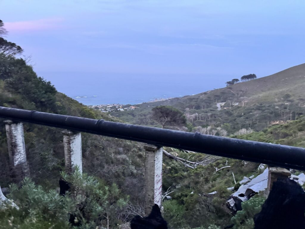
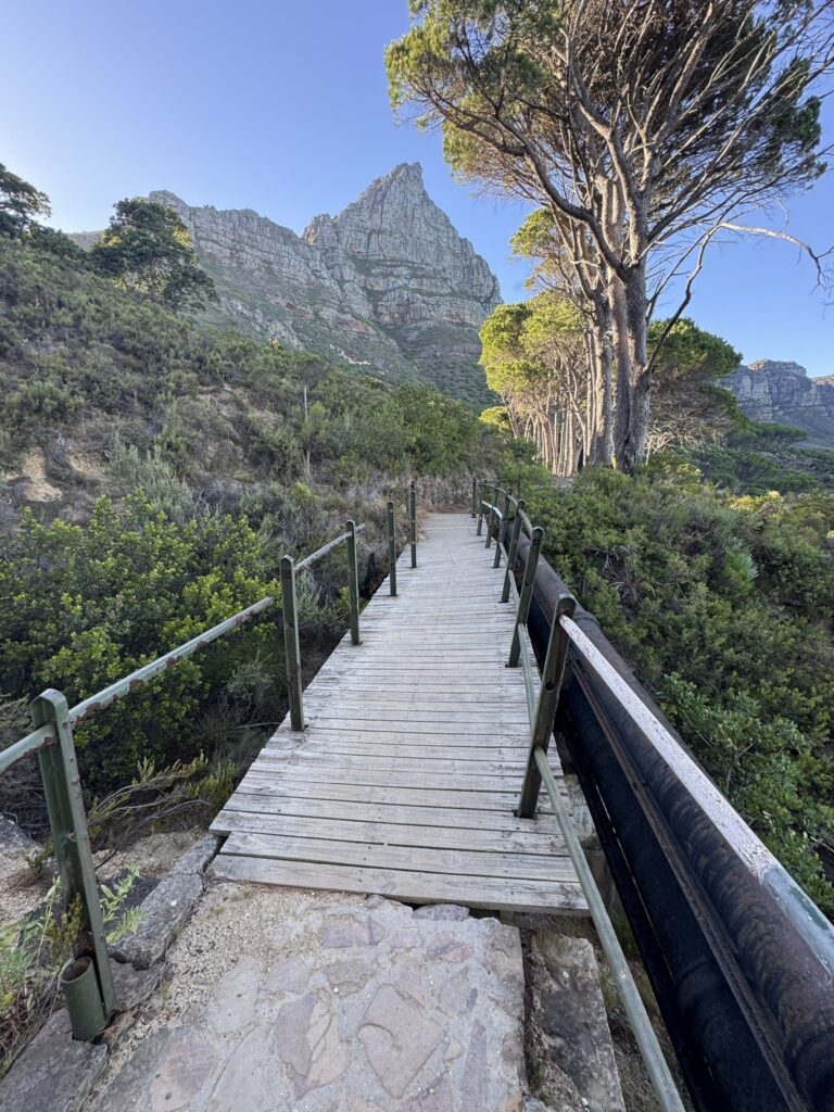
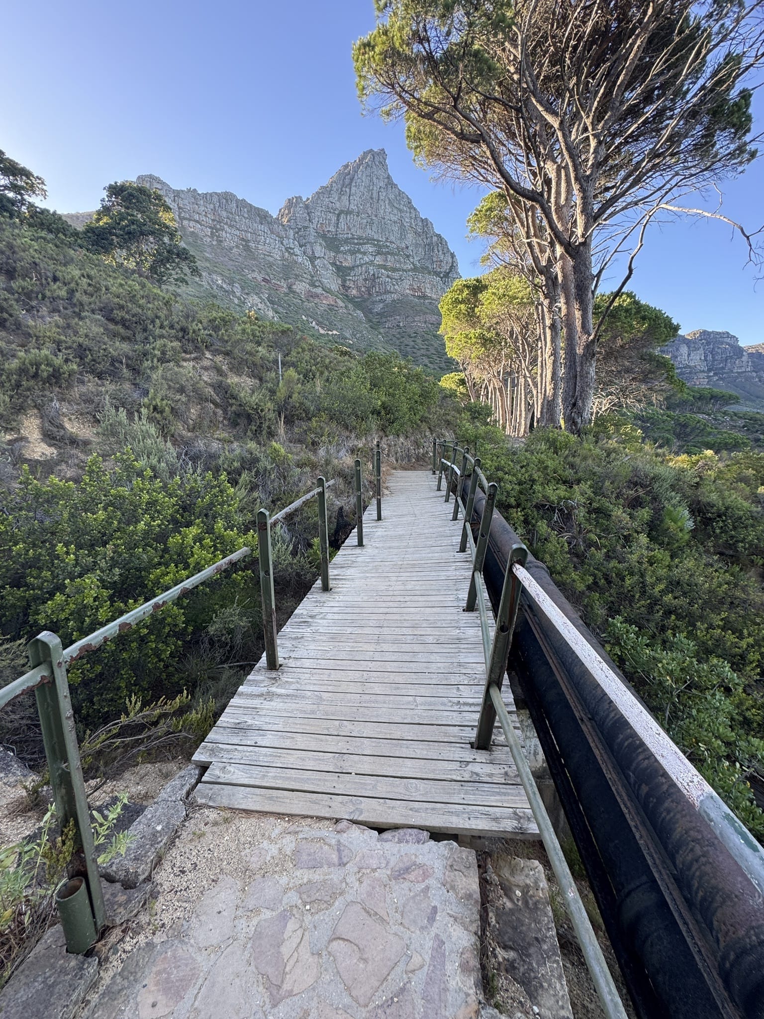
The awkward one on this list, because SANParks measures it at about six kilometres one way and that is not a short walk. It is here because it contours below the Twelve Apostles rather than climbing them, and because you can turn back at any point. Walk half an hour of it and you have still had the best of it.
The Pipe Track is one of Cape Town’s most popular and accessible mountain walks. Instead of climbing to the summit of Table Mountain, it follows the western contour beneath the Twelve Apostles from the junction of Tafelberg Road and Kloof Nek, with Camps Bay and the Atlantic below you the whole way. It contours above the coast rather than descending to it, so it is a there-and-back walk rather than a crossing to the sea.
Originally built to service the historic pipeline that carries water from Table Mountain’s reservoirs, the route is relatively gentle with only minor elevation changes. Its combination of incredible scenery, easy navigation and flexible distance makes it ideal for hikers, runners, walkers and families looking for a rewarding outdoor experience without a strenuous climb.
What easy means here, and what it does not
Easy in this guide means the route does not climb hard, not that it is short and not that it is soft. The Pipe Track is six kilometres one way. Palmiet is three hours. What they have in common is that you can walk them in ordinary shoes and stop whenever you like.
Two practical notes. Silvermine is gated and charges a conservation fee at the entrance, with a last-entry time; Harold Porter is a botanical garden with its own opening hours. The coastal walks are free and open, but they are exposed, so the wind matters more than the distance does.