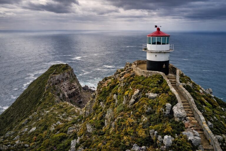
A thirty-three metre cast-iron lighthouse on the exposed Atlantic edge of the Cape Peninsula, still working, and usually open to climb on weekdays.
Slangkop Lighthouse stands on the open Atlantic shore just west of Kommetjie, towards the southern end of the Cape Peninsula. At thirty-three metres it is the tallest cast-iron lighthouse on the South African coast, and it is still a working navigational light rather than a preserved monument. The setting does as much work as the structure. There is low coastal fynbos, dark rock shelving into white water, unbroken Atlantic to the horizon, and the hill rising behind that gives the place its name — Slangkop, the snake head.
The tower itself is worth looking at properly. It is cast iron rather than masonry, built up from curved plate sections bolted together, tapering as it rises and painted white from base to lantern. A railed gallery runs around the top beneath a domed lantern room, and single-storey keeper’s quarters sit at the foot of the tower behind a low fence. Because the surrounding landscape is flat, scrubby and empty, the tower reads as very tall and very slender from a distance, visible from the roads coming into Kommetjie long before you reach it.
A light was needed here because of what this coastline does to shipping. The western edge of the Peninsula is the last stretch that vessels approaching Table Bay from the south and west run along, and it is an unforgiving one: reef, kelp, heavy Atlantic swell and frequent low cloud against a shore that offers nothing to shelter behind. The coast either side of Kommetjie has a long record of wrecks. A commission appointed in 1906 recommended establishing a light at Slangkop.
The construction timeline is the detail most often reported incorrectly. The lens, tower and associated equipment were manufactured in 1914, and completion was expected in that year — a brass sign was even produced carrying the 1914 date. The First World War then intervened, and the lighthouse was not formally completed and commissioned until 1919, with its inauguration on 4 March that year. It appears to have been in use before the official date, as a Royal Navy ship’s log records the light in July 1917. That gap between manufacture, working use and formal commissioning is why you will see 1914, 1917 and 1919 all attached to this lighthouse.
It remains an active navigational lighthouse, operated by Transnet National Ports Authority. The light group-flashes four times every thirty seconds from a first-order revolving lens turning in a bath of mercury, with the focal plane roughly forty-one metres above high water so that the beam sits below the dense mist that regularly settles on this coast. The station was automated in 1979. What was originally a three-man posting has since been held by a single senior lightkeeper, and the site is still staffed rather than left to run itself.
Visitors have generally been able to go inside and climb the tower, which is the main reason to make the trip rather than simply photograph it from the road. The published viewing period is Monday to Friday, roughly 10:00 to 15:00 with a short break around midday, and closed on weekends and public holidays. That information is not published with a clear date attached, so confirm current access before making a special journey. The climb is up a steep, narrow internal spiral staircase, which will rule it out for some visitors and for anyone uneasy with confined stairs or heights. From the gallery at the top the reward is the coastline in both directions, the reef and kelp beds directly below, and open ocean with nothing between you and the South Atlantic.
Getting here is part of it. Kommetjie sits well down the Peninsula, and however you approach — over the mountain from the False Bay side, or down the Atlantic coast — the landscape becomes progressively emptier and more exposed as you go. A road runs out through the village to the lighthouse itself. Most people pair the visit with time on the shoreline nearby, and the wind here is genuine: on a blown-out afternoon the walk from car to tower is bracing in a way that a promenade lighthouse never is. Late afternoon gives the best light on the white tower, but the tower interior closes well before sunset, so the two do not combine.
Highlights
- The tallest cast-iron lighthouse on the South African coast, thirty-three metres high
- A working navigational light operated by Transnet National Ports Authority, not a preserved monument
- Manufactured in 1914, then delayed by the First World War until its inauguration on 4 March 1919
- A steep internal spiral staircase to the lantern gallery when the tower is open
- Open Atlantic coastline, dark rock and low fynbos on the Peninsula’s exposed western edge
- Named after the Slangkop, the snake head hill directly behind the lighthouse
Frequently Asked Questions
How tall is Slangkop Lighthouse, and is it the tallest in South Africa?
The tower is thirty-three metres high, which makes it the tallest cast-iron lighthouse on the South African coast. That precise wording matters. Height can be measured as the tower itself or as the height of the light above the sea, and several shorter South African lighthouses sit on cliffs and headlands that put their lights far higher above the water than this one.
Can you go inside and climb Slangkop Lighthouse?
Usually yes, and the climb is the main reason to come. The published viewing period is Monday to Friday, roughly 10:00 to 15:00 with a short midday break, closed on weekends and public holidays. That information is not published with a clear date attached, so confirm before travelling. The way up is a steep, narrow internal spiral staircase.
When was it built, and why do some sources say 1914?
The lens, tower and equipment were manufactured in 1914 and a brass sign was made bearing that date, but the First World War delayed completion. The lighthouse was commissioned in 1919 and inaugurated on 4 March that year, although a Royal Navy log shows the light was already in use by July 1917. All three dates are genuine, which is why they get mixed up.
Is Slangkop Lighthouse still operational?
Yes. It is an active navigational lighthouse operated by Transnet National Ports Authority. The light group-flashes four times every thirty seconds from a first-order revolving lens turning in a mercury bath, set roughly forty-one metres above high water. The station was automated in 1979 and is still staffed.
Why was a lighthouse built on this stretch of coast?
This is the exposed western edge of the Cape Peninsula, the last stretch ships run along when approaching Table Bay from the south and west, and it combines reef, kelp, heavy swell and frequent low cloud. The coast around Kommetjie has a long record of wrecks. A commission appointed in 1906 recommended establishing a light at Slangkop.